

Section 10. Flood Plain Regulations
10.1 Statement of Purpose
The purpose of these provisions is to prevent the loss or property and life, the creation of health and safety hazards, the disruption of commerce and governmental services, the extraordinary and unnecessary expenditure of public funds for flood protection and relief, and impairment of the tax base by:
- Promoting the general health, welfare, and safety of the community;
- Reducing financial burdens imposed on the community, its governmental units and its individuals by preventing future development in areas subject to periodic flooding;
- Minimization of danger to public health and welfare through protection of water supply and natural drainage pattern;
- Regulation uses, activities, and development which, acting alone or in combination with other existing of future uses, activities, and development, will cause unacceptable increases in flood heights, velocities and frequencies;
- Restricting or prohibiting certain uses, activities, and development from locating within areas subject to flooding;
- Requiring all those uses, activities, and developments that do occur in flood-prone areas to be protected and/or flood-proofed against flooding and flood damage;
- Protecting individuals from buying lands and structures which are unsuited for intended purposes as result of flood hazards;
- Promotion of responsible flood-proofing measures within the areas subject to flooding.
10.2 Warning and Disclaimer of Liability
The degree of flood protection sought by the provisions of this section is considered reasonable for regulatory purposes and is based on acceptable engineering methods of study. Larger floods may occur on rare occasions. Flood heights may be increased by man-made or natural causes, such as ice jams and bridge openings restricted by debris. This section does not imply that areas outside the flood plain districts, or that land uses permitted within such districts, will be free from flooding or flood damages.
This section shall not create liability on the part of the Borough of Somerset or any officer or employee thereof for any flood damages that result from reliance on this ordinance or any administrative decision lawfully made there-under.
10.3 Establishment of Flood-Fringe Districts
10.31 Description of Districts
- The floodway and Flood-Fringe Districts shall include all areas subject to inundation by waters of the one-hundred [100] year flood [Regulatory Flood]. The basis for the delineation of Flood-Fringe district shall be flood profiles and floodway data contained in the Somerset Borough Flood Insurance Study and accompanying maps, as prepared by Michael Baker, Jr., Inc. for the Federal Insurance Administration, dated May, 1976.
- Floodway is that area designated for passage of the water of the 100-year but not located in the Flood-Fringe district. The delineation of the floodway is based upon the principle that said area is identified to carry the waters of the 100-year flood, without increasing the water surface elevation more than [1] foot at any point. Further, the Floodway is specifically defined and delineated in the Flood Insurance Study and accompanying maps for the Borough of Somerset.
- The Flood-Fringe is that area designated as being that part of the 100 year flood plain not included in the Floodway District. The basis for the outermost boundary of this District shall be the one hundred [100] year flood elevations contained in the flood profiles of the above referenced Flood Insurance Study [FIS] and as shown on the accompanying Flood Boundary and Floodway Maps for the Borough of Somerset.
- The Floodway and Flood-Fringe Districts shall be overlays to the existing underlying districts as shown on the Official Zoning Ordinance Map, and as such, the provisions for these two [2] districts shall serve as a supplement to the underlying district provisions.
- Where there happens to be any conflict between the provisions or requirements of either the Floodway or Flood-Fringe District and those of any underlying district the more restrictive provisions and/or those pertaining to the Floodway or Flood Fringe Districts shall apply.
- In the event any provision concerning either the Floodway or Flood-Fringe Districts is declared inapplicable as a result of any legislative or administrative actions of judicial discretion, the basic underlying district provisions shall remain applicable.
10.42 Zoning Map
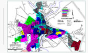
These boundaries of these two [2] flood plain districts are established as shown on the Official Zoning Map of the Borough of Somerset. Said boundaries are available for public inspection in accordance with Article 3, Section 3 of this Ordinance. Please View FEMA Flood Map Service Center for flod plain mapping.
10.43 District Boundary Changes
The delineation of either of the two [2] flood plain districts may be reviewed and revised by the Planning Commission of Somerset Borough where natural or man-made changes have occurred and/or more detailed studies conducted or undertaken by the U.S. Army Corps of Engineers or other qualified agency or individual.
However, in addition to the review and recommendation procedures set forth in Article 3, Section 5 of this Ordinance all Floodway and Flood-Fringe boundary changes shall be subject to review and approval of the Federal Insurance Administration. Please View FEMA Flood Map Service Center for flod plain mapping.
10.5 District Provisions
10.51 Applicability
Prior to any proposed alteration or relocation of any stream, watercourse, etc. within the Borough of Somerset a permit shall be obtained from the Department of Environmental Resources, Dams and Encroachment Division. Further, notification of the proposal shall be given to all affected adjacent municipalities. Copies of such notifications shall be forwarded to both the Federal Insurance Administration and the Department of Community Affairs.
10.52 Floodway District [FW] – Permitted Uses
In the Floodway District no development shall be permitted except where the effect of such development on flood heights is fully offset by accompanying improvements which have been approved by all appropriate local and/or State authorities as required above. The following uses and activities are permitted provided that they are in compliance with provisions of the underlying district and are not prohibited by any other ordinance and provided that they do not require structures, fill, or storage of materials and equipment:
1. Agricultural uses such as general farming, pasture, grazing, outdoor plant nurseries, horticulture, truck farming, forestry, sod farming, and wild crop harvesting.
2. Public and private recreational uses and activities such as parks, day camps, picnic grounds, golf courses, boat launching and swimming areas, hiking, and horseback riding trails, wildlife and nature preserves, game farms, fish hatcheries, trap and skeet ranges, and hunting and fishing areas.
3. Accessory residential uses such as yard areas, gardens, play areas, and pervious parking areas.
4. Accessory industrial and commercial uses such as yard areas, pervious parking and loading areas, airport landing strips, etc.
10.53 Floodway District [FW] – Uses Permitted by Special Exception
The following uses and activities may be permitted by Special Exception provided that they are in compliance with the provisions of the underlying district and are not prohibited by any other Ordinance:
1. Structures except for mobile homes accessory to the uses and activities in Section 10.52 above.
2. Utilities and public facilities and improvements such as railroads, streets, bridges, transmission lines, pipe lines, water and sewage treatment plants, and other similar or related uses.
3. Water-related uses and activities such as marinas, docks, wharves, piers, etc.
4. Extraction of sand, gravel, and other materials.
5. Temporary uses such as circuses, carnivals, and similar activities.
6. Storage of materials and equipment provided that they are not buoyant, flammable or explosive, and are not subject to major damage by flooding, or provided that such material and equipment is firmly anchored to prevent floatation or movement and/or can be readily removed from the area within the time available after the flood warning.
7. Other similar uses and activities provided they cause no increase in flood heights and/or velocities. All uses, activities, and structural developments shall be undertaken in strict compliance with the flood-proofing provisions contained in all other applicable codes and ordinances.
10.54 Floodway-Fringe District [FF] – Permitted Uses
In the Flood-Fringe District the development and/or use of land shall be permitted in accordance with the regulations of the underlying district provided that all such uses, activities, and/or development shall be undertaken in strict compliance with the flood- proofing and related provisions contained in all other applicable codes and ordinances.
10.6 Special Exceptions and Variances – Factors to be Considered
1. The danger of life and property due to increased flood heights or velocities caused by encroachments. No special exception of variance shall be granted for any proposed use, development, or activity that will cause any increase in flood levels during the one hundred [100] year flood.
The Zoning Hearing Board may refer any application and accompanying documentation pertaining to any engineer or other qualified person or agency for technical assistance in evaluating the proposed project in relation to flood heights and velocities, and the adequacy of the plans for protection and other related matters. Special exceptions and/or variances shall only be issued after the Zoning Hearing Board has determined that the granting of such will not result in:
- Unacceptable or prohibited increase in flood heights,
- Additional threats to public safety,
- Extraordinary public expense,
- Create nuisances,
- Cause fraud or victimization of the public, or
- Conflict with local laws or ordinances.
10.7 Existing Structures – Located in Floodway [FW] and Flood-Fringe [FF] Districts
A structure or use of a structure or premises which lawfully existed prior to enactment of these provisions, but which is not in conformity with these provisions may be continued subject to the following conditions:
- Existing structures and/or uses located in the Floodway District shall not be expanded or enlarged [unless the effect of the proposed expansion or enlargement on flood heights is fully offset by accompanying stream improvements].
- Any modification, alteration, repair, reconstruction, or improvement of any kind to a structure and/or use located in the Flood Plain Districts to an extent or amount of less than fifty [50] percent of its market value, shall be elevated and/or flood-proofed to the greatest extent possible.
- The modification, alteration, repair, reconstruction, or improvement of any kind to a structure and/or use in the Flood Plain Districts, to an extent or amount of fifty [50] percent or more of its market value shall be undertaken only in full compliance with the provisions of this and any other applicable ordinance. Ordinance #1063